Jilin—1 GF07 satellite transmits high-resolution photo of Harbin's winter wonderland


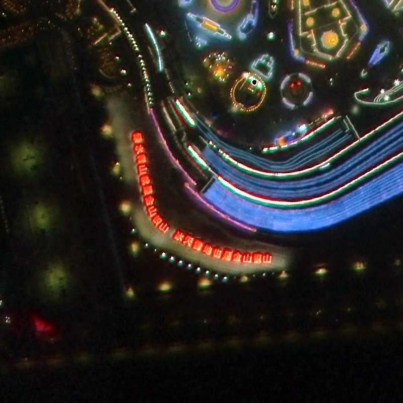
The Jilin—1 GF07 satellite recently transmitted a picture of Heilongjiang province's Harbin Ice and Snow World Park on New Year's Eve, China's first very high-resolution color night-time remote sensing satellite image.
The Jilin—1 GF07 is part of the Jilin-1 satellite family developed by Changguang Satellite Technology based in Changchun, Jilin province. The technology is China's first domestic remote-sensing satellite constellation for commercial purposes. It produces super high-definition images and provides information on various conditions, including forest fires, desertification, offshore rescue, and ocean protection. It can capture artificial light sources on the Earth's surface at night and image low-light areas, providing unique social, economic, and environmental data.


- China-SCO Cooperation Center for Metabolic Diseases opens in Shanghai
- Supervisors blamed for blast at a steel plant that killed 10 and injured 84
- Top work safety body to conduct nationwide assessments and inspection tours after Spring Festival holiday
- Moviegoing becomes a popular new tradition during Spring Festival holiday in Xinjiang prefecture
- Forest and grassland fires fell to a record low in 2025
- Miao ethnic group celebrates Tiaohua Festival in Guizhou